
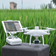


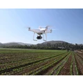

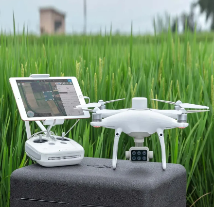


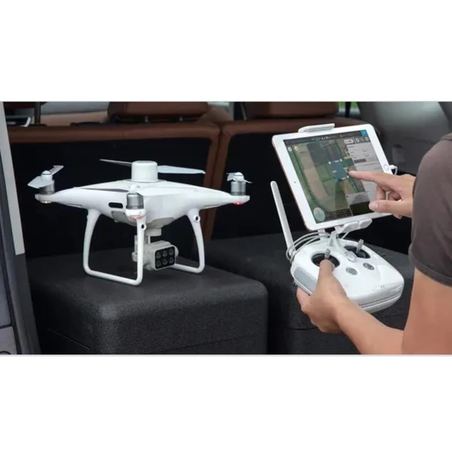


Gather precise plant -level data using the P4 Multispectral – a high precision drone with a seamlessly integr ated multispectral imaging system built for agriculture missions, environmental monitoring, and more.
Phantom 4 Multispectral RTK Drone For Agricultural Industrial Surveying Map With RTK Station
R278751.02
Color:
Categories:
Buy With Confidence
100% Safe Payment
;
You May Also Like...

2023 DJI New Drones DJI Mini 2 SE Fly More Combo 2.7K Video 10km HD Video Transmission 3-Axis Gimbal Camera 31 Mins Flight
R17404.00

DJI Air 3 (DJI RC-N2) Drone 46-Min Max Flight Time Omnidirectional Obstacle Sensing 4K/60fps HDR up to 20Km Video Transmission
R24634.53

Yun Yi High-quality Original Second-hand DJI PHANTOM 4 PRO 4K HD Quadcopter Aerial Photography UAV Standard Combination
R64580.03

Master 5 V2 DJI O3 Sky HD Digital Image Transmission 5 5-Inch FPV Crossing Machine
From R9873.06

DJI Mini 2 SE Camera Drone 31Min Max Flight Time 2.7K/30fps Video 10km HD Video Transmission Professional DJI Original Brand New
R6389.03
Description
 Product DescriptionProduct NamePhantom 4 Multispectral UVAFunctionAgriculture Missions,Environmental Monitoring, and MoreBattery5870 mAhMAX image Size1600×1300 (4:3.25)
-
P4 MULTISPECTRAL
-
Plant Intelligence for Targeted Action
-
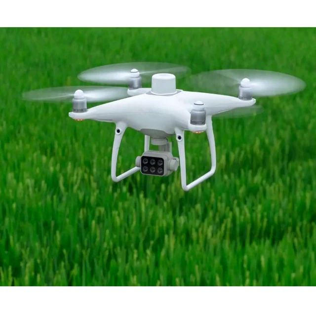
Details ImagesAgriculture imagery collection is now simpler and more efficient than ever before with a built-in stabilized imaging system that collects comprehensive data sets right out of the box. Access information collected by 1 RGB camera and a multispectral camera array with 5 cameras covering Blue, Green, Red, Red Edge, and Near Infrared bands – all at 2 MP with global shutter, on a 3-axis stabilized gimbal.
 Centimeter-level Precision
Get real-time, accurate positioning data on images captured by all six cameras with DJI’s TimeSync system, providing centimeter-level accurate measurements. The TimeSync system continually aligns the flight controller, RGB and NB cameras, and RTK module, fixing the positioning data to the center of the CMOS and ensuring each photo uses the most accurate metadata. All cameras go through a rigorous calibration process where radial and tangential lens distortions are measured. The distortion parameters gathered are saved into each image’s metadata, letting post-processing software adjust uniquely for every user.
 The Beginning of Intelligent Agriculture Missions
Plan Flights
Planflights
execute automated missions, and manage fight data using GS PRO-DJI’s leading flight planning iOS app. Capture Data
Collect multispectral images efficiently across a large area using the P4 Multispectral and gain an overview of problem areas.
 Analyze Data
Easily access and process aerial data by applying plant-specific metrics and parameters to acquire the desired results on plant health.


 Certifications
 FAQ
FAQ1.How is the P4 Multispectral different from the Phantom 4 RTK?
Both are RTK-enabled, all-in-one drone platforms. The main difference is the camera.2.What propellers does the P4 Multispectral use?It uses the 9455S Low-Noise Propellers. The Phantom 4 Series propellers are also compatible, but flight performance will be affected.3.How do I take care of the Spectral Sunlight Sensor on top of the drone?Keep it away from hard, sharp objects to prevent scratching.4.What are the capabilities of the multispectral camera array of the P4 Multispectral?The multispectral imaging system of the P4 Multispectral detects light emissivity of different objects, which is captured by each of the cameras and analyzed to calculate vegetation index values.5.Do I need to use a high-speed SD card for the cameras?Yes. Please refer to the user manual when choosing an SD card.6.Which remote controller is compatible with the P4 Multispectral?Currently, the P4 Multispectral is only compatible with the SDK Remote Controller that comes with the aircraft.7.What is the resolution of the transmission of the P4 Multispectral?
720p.8.Can I use the P4 Multispectral battery on the Phantom 4 RTK?Yes.9.How long does a P4 Multispectral battery last?A new battery lasts around 27 minutes.10.How long does it take to charge a P4 Multispectral battery?Around 58 minutes.11.How about your delivery time?
Generally, it will take 10 to 15days after receiving your advance payment. The specific delivery time depends on the items and the quantity of your order.
12.How do you make our business long-term and good relationship?We keep good quality and competitive price to ensure our customers benefit ;We respect every customer as our friend and we sincerely do business and make friends with them, no matter where they come from.Packing&ShippingOptional Packing :Wood Box/Aluminum Case


 Our Service
1、We supply one stop drone solutions and re-equip,to satisfy the need of industrial, agricultural security and rescue ect.. professional field.
2、We will reply you for your inquiry in 24 hours.3、Our Q&C team will inspect every product quality strictly before delivery.4、After delivery, we will track the products for you once every two days, until you get the products. When you got the goods, test them, and give me a feedback.If you have any questions about the problem, contact with us, we will offer the solve way for you.5、We can provide UAS operators training and agricultural spraying technical guidance through network teaching by company professor.-

Follow us on: